OpenStreetMap is a free to use, collaborative mapping project continually updated by a large community of contributors worldwide. As it is open data, it is allowed to be used for any purpose, but has come to play an increasingly important role in the area of humanitarian aid. In the aftermath of the 2010 Haiti earthquake, it was quickly used to build a very complete digital picture of the terrain, buildings and roads in the worst affected areas, proving an invaluable resource to aid workers in the region. Since then, primarily through its tasking manager site, humanitarian crises are tracked and prioritised so the large number of subscribed mappers can use satellite imagery and other resources to get important geographical information to aid workers on the ground.
I recently set up an account with OpenStreetMap in order to begin contributing to the project. The prospect of getting to grips with the tools was a little daunting at first, but there are some excellent tutorials and introductory videos available on openstreetmap.org which I found to be a great help. Despite the gravity of the work being done the tutorials successfully get across how much the organisers want people to become involved, stressing the value of even a minimal level of involvement, which I found very reassuring.
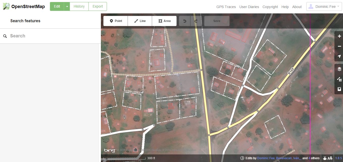
The process of becoming a contributing mapper is essentially quite simple. After having signed up to the project, you are free to begin contributing to the map of any part of the world you like, by simply searching for the desired location, and choosing to edit it, which can be done with a set of intuitive mapping tools accessible from within your browser. The user interface provides several tools which you can use to add information of different types to a map. With a little practice these provide the means to intuitively trace out and identify a full range of geographical features including houses, roads, residential areas, coastlines and so on. Additional information on the mapped features (if known to the user) can be added using a panel on the left of the screen. I found the interface responsive, uncluttered and user-friendly, with handy keyboard shortcuts mapped to many of the more commonly used functions.
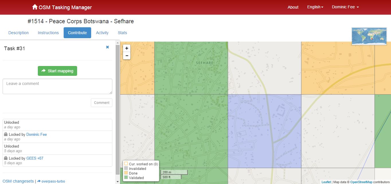
Having practiced a little with the tools I visited the OSM Tasking Manager at http://tasks.hotosm.org/ in order to contribute to the ongoing humanitarian work. I decided to work on some regions of the map of Botswana, particularly in Mochudi and Sephare. For each region, there is a detailed description of the type of relief work being carried out in the area and instructions on the particular geographical features to be prioritised. In Botswana, there are many parts of the map where buildings and roads have not yet been marked out. This information is vital to facilitate the ongoing treatment programs which are tackling the high incidence of HIV/AIDS and TB in the country. I’ll admit to a strong initial sense of apprehension before beginning the mapping process, after all, this work may well have consequences in the real world. However, the process is truly collaborative, and there’s a strong sense of support there. Firstly, the regions are divided into tiles of a manageable size, which can be further subdivided into smaller zones if needed. Secondly, you can save your work at any time and come back later. The tiles are also validated and modified if necessary by more experienced mappers when they are declared finished, (who may well possess more detailed local knowledge), so you never feel that you are working alone.
As part of my current MA in Digital Arts & Humanities, it is my intention to develop a series of interactive, web-based activities in order to teach people about the principles of design in fine art paintings, with particular reference to the geometric abstraction genre. Although OpenStreetMap is an entirely different proposition, I think aspects of the experience of working with it will inform my research. In particular, for any project requiring user interaction, a well designed, easy to grasp user interface would seem to be vital. Enabling the user to render virtually any type of geographical feature they may encounter would seem to be a very complex problem, yet the OSM interface manages it with just three simple buttons, allowing you to work with points, lines and areas. Each of these behave in distinct ways, providing contextual visual feedback to the user. Also, there is a tiered structure to the information a user may enter. A traced line may be designated as a road, river or fence, but a road may be further categorised as any one of a number of types of road, and be named. This allows a contributor to engage with the map at a level appropriate to their experience and knowledge. Though my project will hardly feature this level of complexity, I can see how these would be important issues to consider in the design process of any interactive environment.
Also, while using OSM, I was reminded of the work of game designer Jane McGonigal, whose TED talk “Gaming Can Make a Better World” was part of the prescribed content for the Models, Simulations & Games module I’m also taking. In it, she points out that in online multiplayer games such as World of Warcraft, people exhibit certain types of behaviour and attitudes towards solving problems and achieving goals. These include very positive attitudes such as “urgent optimism” – the willingness to throw oneself into a task with great enthusiasm, “blissful productivity” – the feeling of satisfaction that comes from being engaged in hard work, and a willingness to team up and collaborate with a large community in which you place great trust. She is concerned that these attitudes don’t appear to be as prevalent in reality, and argues that if we could harness gamers’ energy and apply it to actual world problems we could make great progress. Having initially heard her arguments, I concluded that while they were intriguing and well intentioned, they exhibited a degree of naivety. However, having used OpenStreetMap, and sensed all of these attitudes at play there, I now realise she may be on to something.